Topographic
Stepped elevation terraces from an internal terrain field or a plugged-in height map, with contour and rainbow color modes.
The Topographic node turns a height field into stepped elevation terraces — the layered look of a contour map or a paper relief model. It generates its own terrain by default, or reads a height map from its input, and colors the result as a rainbow, a gradient, grayscale height, or contour lines.
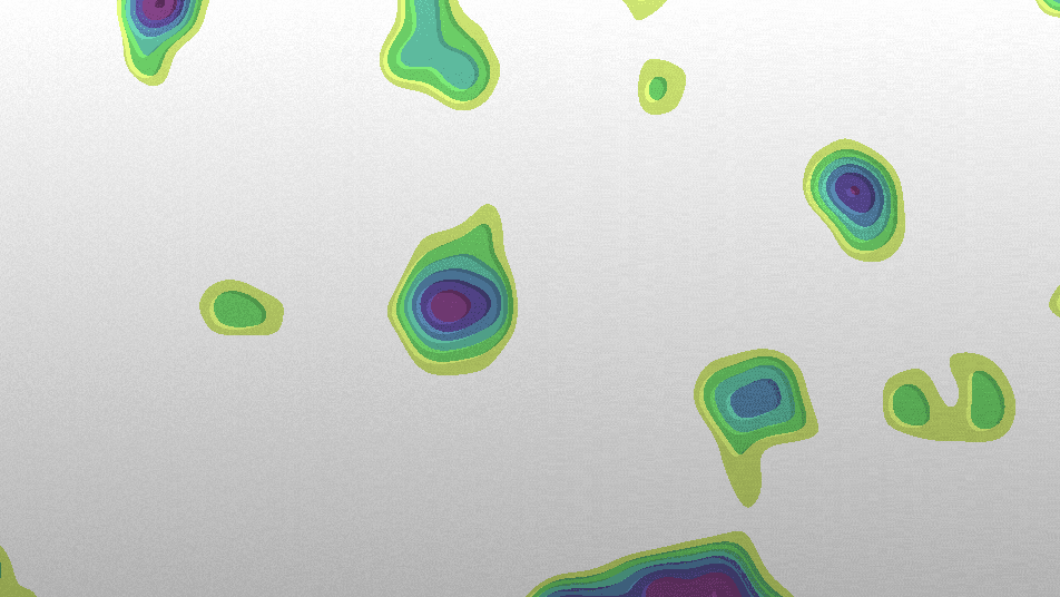
- One texture output; two optional texture inputs (height source and composite)
- Terrain, terrace, and color controls; four Color Mode looks
- Wire any generator into Height Input to terrace its luminance instead of the internal terrain
- Found in the node graph under Generators as Topographic
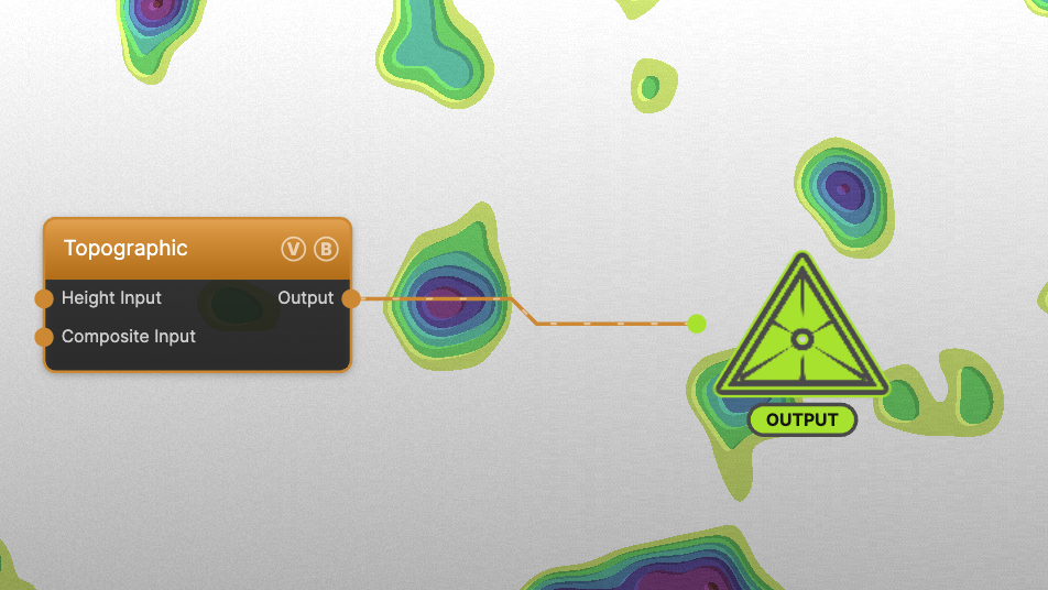
The image on the right is the example patch itself — drag and drop it onto the app (or load it with File → Load) to open the full graph.
Inputs and outputs
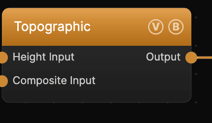
| Port | Type | Purpose |
|---|---|---|
| Height Input | Texture | When connected, its luminance replaces the internal terrain — terrace any generator or image by its brightness |
| Composite Input | Texture | Composited under the output with Composite Mode and Composite Mix, which appear once the port is wired |
| Output | Texture | The terraced, colored elevation map |
Parameters
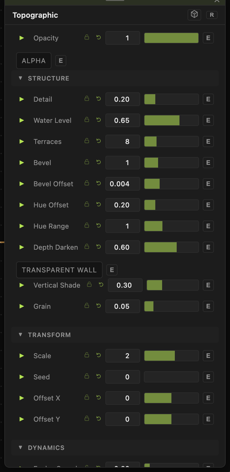
Opacity, Blend Mode — the standard operator header; see Perlin Noise.
Terrain
Ignored when a Height Input is connected.
- Scale (0.1–20, default 2) — terrain frequency. Detail (0–1, default 0.2) — fine relief on top of the base shape.
- Seed, Offset X / Offset Y — pick and pan the terrain.
- Evolve Speed (0–3, default 0.3) — how fast the terrain morphs over time.
Terraces
- Water Level (0–1, default 0.65) — the cutoff below which terrain reads as flat water/floor.
- Terraces (1–64, default 8) — number of elevation steps.
- Bevel (0–4, default 1) and Bevel Offset — the shading and width of each step's edge.
Color
- Color Mode — Rainbow (default, hue by elevation), Gradient (your own inline gradient), Height (grayscale), or Contour Lines (isolines on a spatial rainbow).
- Hue Offset, Hue Range, Saturation, Brightness — drive the Rainbow and Contour palettes. Depth Darken (Rainbow only) shades lower terraces. Line Width (Contour only) sets isoline thickness.
- Wall Color, Transparent Wall — the vertical faces between terraces.
Post
- Vertical Shade (0–1, default 0.3) and Grain (0–0.3, default 0.05) — subtle shading and texture on the final image.
Every slider has a per-parameter animation bar, so any of these can be animated, audio-driven, or MIDI-mapped — see Parameters and Controls.
Troubleshooting
Everything is one flat color — Terraces is very low, or Water Level is near 1 so most of the field reads as water. Raise Terraces and lower Water Level.
Height Input seems ignored — only its luminance is read; a very dark input gives a flat map. The internal Terrain sliders have no effect while an input is connected.
Gradient mode looks wrong — set Color Mode to Gradient, then edit the stops in the inline gradient editor in the parameters panel.